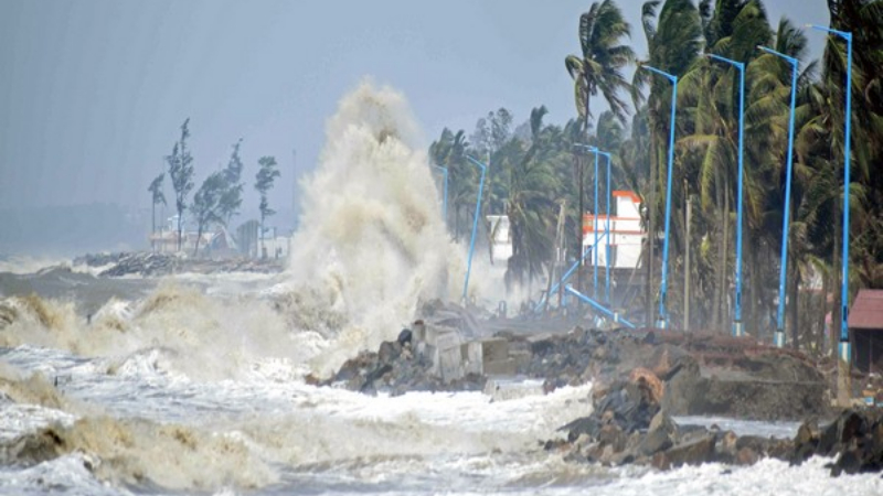
The eastern horizon over Andhra Pradesh had long been a canvas of blue and sunshine, but on the evening of November 2, 2026, that canvas began to bleed. Dark clouds rolled in from the Bay of Bengal, and a steady drizzle turned into a relentless downpour that would set the stage for a cyclone’s dramatic arrival.

The India Meteorological Department (IMD) had been tracking a developing system, designated Murasu, for days. By the morning of November 3, the cyclone had sharpened into a Category 3 storm, with sustained winds poised between 100 and 120 km/h. The IMD’s bulletin that day read: "Landfall process continues. In the forward sector of cyclone, major part of wall cloud entered into land and eye is entering the coast." The warning was clear: heavy rain and gale‑force winds were imminent.
At dawn on November 3, Murasu made landfall near Ongole, a coastal town in the Prakasam district. The eye of the cyclone, a calm eye surrounded by a wall of clouds, slid across the shoreline, bringing a sudden burst of wind that rattled windows and toppled mangrove roots. The wind gusts reached 120 km/h in some spots, while the steady winds hovered around 100 km/h, enough to uproot trees and power lines.
The city’s traffic management center issued advisories, urging residents to stay indoors and avoid low‑lying roads.
The storm surge, a rise in sea level caused by the cyclone’s low pressure and strong winds, was projected to reach between 1.0 and 1.5 meters. This surge threatened to inundate low‑lying areas along the coast, especially in districts such as Nellore, Prakasam, and Kothapeta. The IMD’s forecast warned that the surge could flood homes, disrupt transport, and overwhelm drainage systems.
Even the capital city of Amaravati felt the cyclone’s reach. Heavy rain, lasting for roughly twelve hours, caused waterlogging in several neighborhoods. Streets that normally bustle with traffic became rivers of muddy water, and commuters were forced to find alternative routes. The city’s traffic management center issued advisories, urging residents to stay indoors and avoid low‑lying roads.
Chief Minister Chandrababu Naidu, who had been monitoring the situation closely, issued a directive to officials in the affected districts. "We must monitor the situation in Nellore, Prakasam, and Kothapeta closely," he said. His call emphasized the need for vigilance and preparedness, as the cyclone’s path could shift and intensify.
Despite the ferocity of the storm, there were no immediate reports of casualties. Emergency services were on standby, and local authorities had set up shelters in anticipation of potential flooding. The absence of fatalities was a relief, but the damage to infrastructure and the threat of future waves of rain kept the region on high alert.
As the cyclone’s eye moved inland, the winds began to weaken, but the rain persisted. The IMD continued to issue updates, noting that the heavy rainfall could continue for several hours more. Residents in the coastal districts were advised to stay indoors and keep a close eye on official channels for any changes in the storm’s trajectory.
Cyclone Murasu’s landfall is a stark reminder of the vulnerability of India’s coastal communities. While the immediate threat of loss of life was mitigated, the economic and environmental impacts—damaged crops, disrupted transportation, and the risk of flooding—will linger for weeks. The event underscores the importance of robust early‑warning systems and community preparedness in the face of increasingly volatile weather patterns.