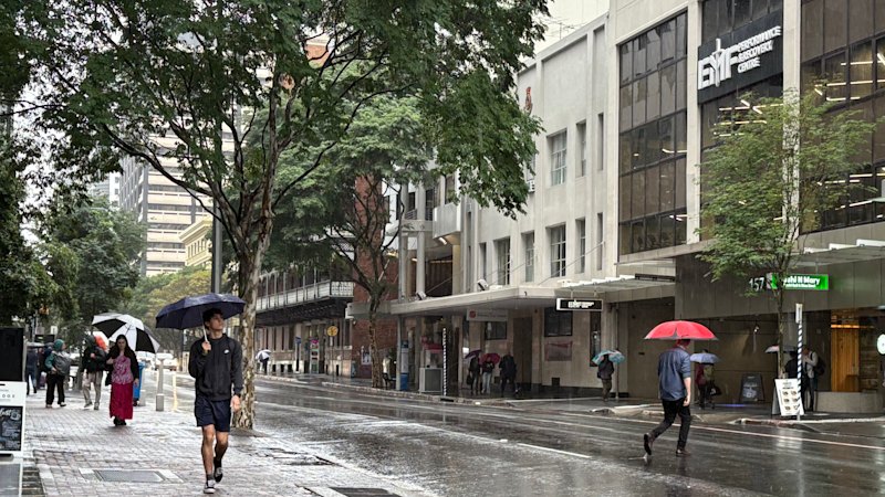
For the residents of southeast Queensland, the current week has been defined by a relentless and uncharacteristic atmospheric event. A significant weather system has parked itself over the region, bringing with it heavy rain and persistent storms that have fundamentally altered the landscape. This is not merely a seasonal shower; the region is currently experiencing rainfall totals that reach two to four times the average expected for the month of October. The sheer volume of water falling across the landscape has turned familiar terrain into a saturated, high-stakes environment, testing the resilience of infrastructure and the patience of those living in the path of the storm.

While the impact is felt broadly, certain areas have borne the brunt of the atmospheric instability. The inland Wide Bay-Burnett region, situated north of Brisbane, along with the Central Ranges, has been particularly hard hit. These areas have recorded rainfall totals between 200 and 300 millimetres, a staggering amount that underscores the intensity of the current weather pattern. Across the broader state of Queensland, these localized totals have contributed to the region recording the highest rainfall figures in the country, marking this October as a period of significant hydrological stress.
As of October 25, 2026, the atmosphere remains charged. A severe thunderstorm warning has been in place across southeast Queensland, serving as a stark reminder of the volatility inherent in this system. The danger is not just in the volume of the rain, but in the unpredictability of the storms that continue to develop. Even as the system shows signs of weakening and beginning its slow migration out of the area, the threat remains immediate. Residents have been urged to remain vigilant, as the transition from a storm-heavy environment to a more stable one is rarely a linear process.
Despite the pervasive dampness, the region is experiencing a curious meteorological paradox.
Despite the pervasive dampness, the region is experiencing a curious meteorological paradox. Today, temperatures are expected to range between 30 and 31 degrees. This heat, while perhaps counterintuitive in the midst of a deluge, is a hallmark of the tropical and subtropical moisture that is fueling the storms. The combination of high humidity and elevated temperatures creates an environment where the air can hold immense amounts of moisture, which then releases in sudden, intense bursts. It is a reminder that in Queensland, the weather is often a complex interplay of heat and water, rather than a simple matter of temperature alone.
There is, however, a light at the end of the tunnel. By the weekend, the current weather system is expected to have largely dissipated, giving way to what meteorologists describe as "bright and clean" conditions. This shift represents a fundamental change in the air mass moving over the region, replacing the heavy, moisture-laden air with a cooler, more stable atmosphere. For those who have spent the week navigating flooded roads and the constant hum of thunder, the promise of a clear horizon is a welcome forecast.
As the week progresses, the transition will be gradual. The coming days are expected to bring longer gaps between rain events, offering a reprieve from the constant downpour. While there remains a lingering chance of severe storms returning in the afternoon—a common feature of the region’s climate even as a system exits—the overall trend is toward improvement.

Las nevadas en Australia There’s been another good top up [of snow] … given they had a nice dump three or four days ago. Hines said there was about 30cm of snow in widespread higher parts of mountains in Victoria and New South Wales on Friday evening, with an additional 20cm expected on average over the next day, bringing high peaks of half a metre. He said there hadn’t yet been snow reaching low levels as occurred last week in a number of places across NSW up to the Queensland border, but low lying communities in northern Victoria and southern New South Wales, including the tablelands, could receive some snowfall in coming days. It came amid widespread damaging wind warnings across Australia, stretching from southern parts of South Australia through exposed parts of Victoria and alpine and eastern NSW. A severe weather warning was in place for Sydney due to the strengthening winds, bringing blizzard-like conditions to areas with snowfall. At Mt Buller, gusts of up to 100km/h were reported on the upper mountain overnight, with conditions calming into Saturday. Hines said some areas in Queensland had received record low temperatures overnight, including Winton, which was -0.6 on Saturday morning – a record in 22 years of data – and Longreach, which dropped to 0.7 – the coldest temperature in three years. The cold front was expected to pass across the next two to three days, however with wind chill temperatures were expected to “feel cooler than it looks like”.